Category:Cheadle Heath
Jump to navigation
Jump to search
English: Cheadle Heath is in the Edgeley and Cheadle Heath ward of the Metropolitan Borough of Stockport
Subcategories
This category has the following 2 subcategories, out of 2 total.
C
Media in category "Cheadle Heath"
The following 55 files are in this category, out of 55 total.
-
 Alexandra Park - geograph.org.uk - 1449316.jpg 640 × 480; 176 KB
-
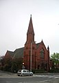
 All Hallows - geograph.org.uk - 77759.jpg 640 × 480; 94 KB
-
 Allotments on St. Lesmo Road - geograph.org.uk - 3349044.jpg 4,000 × 3,000; 4.84 MB
-
 Behind the former Co-operative store - geograph.org.uk - 6359328.jpg 1,280 × 803; 717 KB
-
 Bird Hall Lane, Cheadle Heath - geograph.org.uk - 2625093.jpg 640 × 480; 247 KB
-
 Birdhall Lane - geograph.org.uk - 3071433.jpg 640 × 493; 149 KB
-
 Birdhall Lane - geograph.org.uk - 3071447.jpg 640 × 507; 213 KB
-
 Birdhall Lane Underpass - geograph.org.uk - 3071441.jpg 640 × 542; 192 KB
-
 Birdhall Lane, Cheadle Heath - panoramio.jpg 3,072 × 2,304; 1.83 MB
-
 Bus stop on Birdhall Lane - geograph.org.uk - 3071464.jpg 640 × 533; 185 KB
-
 Business park on Spectrum Way - geograph.org.uk - 3348655.jpg 800 × 600; 86 KB
-

-
 Cheadle Heath Convenience Store - geograph.org.uk - 6359235.jpg 1,280 × 775; 677 KB
-
-
 Cheadle Heath roundabout - geograph.org.uk - 6358210.jpg 1,280 × 1,044; 1.27 MB
-
 Cheadle Royal Business Park - geograph.org.uk - 1181199.jpg 600 × 358; 83 KB
-

-
 Corner shop, St. Lesmo Road - geograph.org.uk - 3349050.jpg 4,000 × 3,000; 4.3 MB
-

-
 Europa Business Park - geograph.org.uk - 3689913.jpg 3,872 × 2,592; 3.09 MB
-
 Farmers Arms - geograph.org.uk - 6360121.jpg 1,280 × 888; 822 KB
-
 Former Co-operative store, Architectural detail - geograph.org.uk - 6359311.jpg 1,280 × 1,091; 945 KB
-
 Gorsey Bank Footbridge, Cheadle Heath - geograph.org.uk - 1900476.jpg 640 × 480; 110 KB
-
 Heathside Park Road - geograph.org.uk - 6358219.jpg 1,280 × 960; 989 KB
-
 Morrison's Cheadle Heath - geograph.org.uk - 1592285.jpg 640 × 396; 44 KB
-
 Morrisons Store, Cheadle Heath - geograph.org.uk - 5048710.jpg 640 × 480; 468 KB
-
 Morrisons Supermarket, Cheadle Heath - geograph.org.uk - 2624821.jpg 640 × 480; 164 KB
-

-
 Morrisons' Petrol Station, Cheadle Heath - geograph.org.uk - 2624838.jpg 640 × 480; 158 KB
-
 Morrisons' Roundabout, Cheadle Heath - geograph.org.uk - 2624827.jpg 640 × 480; 164 KB
-
 Morrisons, Cheadle Heath - geograph.org.uk - 2624830.jpg 640 × 480; 199 KB
-
 Park Square - geograph.org.uk - 3689926.jpg 3,872 × 2,592; 3.95 MB
-
 Park Square, Cheadle Heath - panoramio.jpg 960 × 720; 185 KB
-
 Railway Bridge, Bird Hall Lane - geograph.org.uk - 2625090.jpg 640 × 480; 254 KB
-
 Rain on Edgeley Road, Cheadle Heath - geograph.org.uk - 3105078.jpg 3,872 × 2,592; 3.83 MB
-
 Residential Estate at Cheadle Heath - geograph.org.uk - 5048713.jpg 640 × 480; 531 KB
-
 Shaftesbury Road - geograph.org.uk - 3071405.jpg 640 × 550; 137 KB
-
 Shaftesbury Road Sandwich Shop - geograph.org.uk - 3071417.jpg 640 × 505; 179 KB
-
 Shops, Stockport Road, Cheadle Heath - geograph.org.uk - 3607664.jpg 640 × 384; 293 KB
-

-
 St John's Methodist Church, Cheadle - geograph.org.uk - 403386.jpg 445 × 622; 56 KB
-
 Stockport Road outside the Farmers Arms - geograph.org.uk - 6360139.jpg 1,200 × 1,600; 289 KB
-

-
 Tesco Express, Cheadle Heath - geograph.org.uk - 6358395.jpg 1,280 × 962; 861 KB
-
 The Farmers Arms, Cheadle Heath - geograph.org.uk - 3105095.jpg 3,872 × 2,592; 3.79 MB
-
 Vacant Warehousing - geograph.org.uk - 3071455.jpg 640 × 480; 141 KB
-
 View of Cheadle Heath from Cuzzons, February 2007 - panoramio.jpg 2,048 × 1,536; 934 KB
-
 Weir on the Mersey - geograph.org.uk - 29116.jpg 640 × 423; 101 KB
-
 Weir on the River Mersey - geograph.org.uk - 56715.jpg 640 × 480; 101 KB
-
 Winter Hill from Cheadle Heath - panoramio.jpg 2,048 × 1,536; 480 KB
-
 Wythenshawe from Park Square, Cheadle Heath - panoramio.jpg 2,048 × 1,536; 422 KB
-
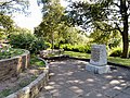
 Alexandra Park Stone - geograph.org.uk - 1449325.jpg 640 × 480; 177 KB
-
 Citadel - geograph.org.uk - 77744.jpg 640 × 480; 110 KB
-
 Councillor Lane Resource Centre - geograph.org.uk - 77795.jpg 640 × 480; 113 KB
-
 Meadowbank Primary School - geograph.org.uk - 77750.jpg 640 × 480; 145 KB


